Description
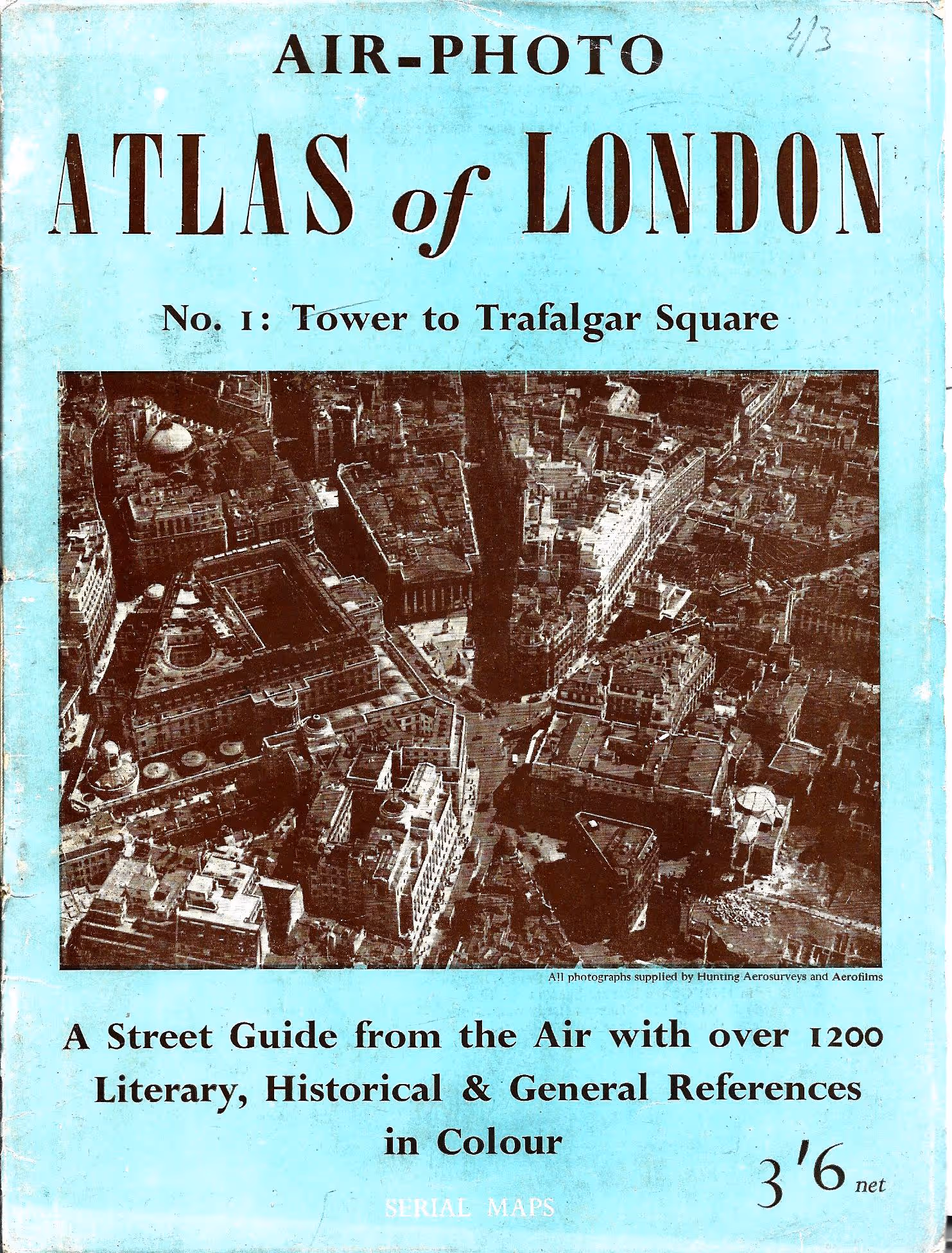
Aerial maps of London, published in 1949. Each photo has the street names on the photo and number and underneath are all the numbers listed, alongside which are listed the names of the building, hall, memorial, etc
$70.00
Aerial maps of London, published in 1949. Each photo has the street names on the photo and number and underneath are all the numbers listed, alongside which…
1 in stock
Aerial maps of London, published in 1949. Each photo has the street names on the photo and number and underneath are all the numbers listed, alongside which are listed the names of the building, hall, memorial, etc
| Weight | 0.073 kg |
|---|---|
| Dimensions | 30 × 24 × 0.1 cm |
| Author | Hunting Aerosurveys (photos) & London County Council and others |
| Year | 1949 |
| Pages | 24 |
| Format | Softcover |
| Condition | Good |


Reviews
There are no reviews yet.